
Wheelhouse Weather
Virginia Beach, VA · NOAA forecast, buoy and tide data · updated Sat, Nov 21, 9:02 PM ET
Big water out there. If you can pick another day, pick it.
No active NWS advisories for this water right now.
ANZ656 · Coastal Waters from Cape Charles Light to Virginia-North Carolina border out 20 NM · issued Sat, Nov 21, 3:00 PM ET
- THROUGH 7 PMNE winds 10 to 15 kt with gusts up to 20 kt. Seas 3 to 4 ft, occasionally to 6 ft. Wave Detail: SE 4 ft at 8 seconds.
- TONIGHTE winds 10 to 15 kt with gusts up to 20 kt. Seas 5 to 6 ft, occasionally to 9 ft. Wave Detail: SE 5 ft at 8 seconds. A chance of showers late.
- SUNNE winds 15 to 20 kt, diminishing to 10 to 15 kt in the afternoon. Gusts up to 25 kt. Seas 6 to 8 ft, occasionally to 12 ft. Wave Detail: SE 8 ft at 10 seconds. A chance of showers.
- SUN NIGHTNW winds 10 to 15 kt, diminishing to 5 to 10 kt after midnight. Seas 6 to 7 ft, occasionally to 10 ft, subsiding to 4 to 5 ft, occasionally to 7 ft after midnight. Wave Detail: SE 7 ft at 10 seconds, becoming SE 5 ft at 9 seconds and NE 2 ft at 7 seconds. A chance of showers.
- MONW winds 5 to 10 kt with gusts up to 15 kt, becoming NW in the afternoon. Seas 4 to 5 ft, occasionally to 7 ft. Wave Detail: SE 5 ft at 9 seconds and NE 2 ft at 8 seconds.
- MON NIGHTN winds 10 to 15 kt with gusts up to 20 kt, increasing to 20 to 25 kt with gusts up to 30 kt after midnight. Seas 4 to 5 ft, occasionally to 7 ft. Wave Detail: SE 4 ft at 9 seconds and N 3 ft at 3 seconds.
- TUEN winds 20 to 25 kt with gusts up to 30 kt. Seas 5 to 6 ft, occasionally to 9 ft.
- TUE NIGHTNE winds 20 to 25 kt with gusts up to 30 kt. Seas 6 to 7 ft, occasionally to 10 ft.
- WEDNE winds 25 to 30 kt. Gusts up to 30 kt, increasing to 40 kt in the afternoon. Seas 7 to 9 ft, occasionally to 13 ft. A chance of showers in the afternoon.
- WED NIGHTNE winds 35 to 40 kt with gusts up to 45 kt. Seas 9 to 11 ft, occasionally to 16 ft. Showers. $$
Quoted from the National Weather Service. Where this and the model below disagree, this is the forecast to trust.
Every pill pulls its own numbers for that spot (36.85°N, 75.98°W). Pick a new one and the grid below reloads for it.
Scroll sideways for the wind, gusts, air temp, water, seas and tide at Virginia Beach through the next five days, with the moon phase under each day.
| Day | Sat, Nov 21 | Sun, Nov 22 | Mon, Nov 23 | Tue, Nov 24 | Wed, Nov 25 | |||||||||||||||||||||||||||||||||||||||||||||
|---|---|---|---|---|---|---|---|---|---|---|---|---|---|---|---|---|---|---|---|---|---|---|---|---|---|---|---|---|---|---|---|---|---|---|---|---|---|---|---|---|---|---|---|---|---|---|---|---|---|---|
| Time | 9 PM | 11 PM | 1 AM | 3 AM | 5 AM | 7 AM | 9 AM | 11 AM | 1 PM | 3 PM | 5 PM | 7 PM | 9 PM | 11 PM | 1 AM | 3 AM | 5 AM | 7 AM | 9 AM | 11 AM | 1 PM | 3 PM | 5 PM | 7 PM | 9 PM | 11 PM | 1 AM | 3 AM | 5 AM | 7 AM | 9 AM | 11 AM | 1 PM | 3 PM | 5 PM | 7 PM | 9 PM | 11 PM | 1 AM | 3 AM | 5 AM | 7 AM | 9 AM | 11 AM | 1 PM | 3 PM | 5 PM | 7 PM | 9 PM | 11 PM |
| Sky | ||||||||||||||||||||||||||||||||||||||||||||||||||
| Wind | E 9 kt | E 9 kt | E 10 kt | E 10 kt | E 11 kt | E 12 kt | NE 14 kt | NE 14 kt | NE 12 kt | N 11 kt | NW 10 kt | NW 9 kt | NW 8 kt | NW 7 kt | NW 6 kt | NW 6 kt | NW 6 kt | W 6 kt | W 5 kt | W 5 kt | NW 5 kt | N 3 kt | NE 2 kt | NE 3 kt | N 7 kt | N 12 kt | N 17 kt | N 18 kt | N 18 kt | N 18 kt | N 19 kt | N 19 kt | N 17 kt | N 17 kt | N 16 kt | NE 16 kt | NE 16 kt | NE 16 kt | NE 16 kt | NE 17 kt | NE 18 kt | NE 19 kt | NE 20 kt | NE 21 kt | NE 22 kt | NE 23 kt | NE 24 kt | NE 25 kt | NE 24 kt | NE 24 kt |
| Gusts | — | — | — | — | — | — | — | — | — | — | — | — | — | — | — | — | — | — | — | — | — | — | — | — | — | — | — | — | — | — | — | — | — | — | — | — | — | — | — | — | — | — | — | — | — | — | — | — | — | — |
| Air | 60° | 60° | 61° | 60° | 61° | 61° | 64° | 66° | 67° | 65° | 63° | 61° | 59° | 58° | 57° | 56° | 56° | 55° | 59° | 63° | 65° | 65° | 62° | 58° | 56° | 54° | 52° | 50° | 48° | 47° | 51° | 53° | 53° | 52° | 49° | 46° | 44° | 44° | 45° | 46° | 46° | 48° | 54° | 58° | 58° | 59° | 58° | 56° | 55° | 55° |
| Water | 59° | 59° | 59° | 59° | 59° | 59° | 59° | 59° | 59° | 59° | 59° | 59° | 59° | 59° | 59° | 58° | 58° | 58° | 59° | 59° | 59° | 59° | 59° | 59° | 59° | 59° | 59° | 59° | 58° | 58° | 58° | 58° | 58° | 58° | 58° | 58° | 58° | 58° | 58° | 58° | 58° | 58° | 58° | 58° | 58° | 58° | 58° | 58° | 58° | 58° |
| Seas | 3 ft 5s | 3.1 ft 6s | 3.2 ft 6s | 3.4 ft 6s | 3.5 ft 6s | 3.7 ft 6s | 3.8 ft 6s | 4 ft 7s | 4.2 ft 7s | 4.4 ft 7s | 4.5 ft 7s | 4.5 ft 7s | 4.4 ft 8s | 4.3 ft 8s | 4.1 ft 8s | 3.9 ft 8s | 3.7 ft 8s | 3.5 ft 8s | 3.3 ft 8s | 3.2 ft 8s | 3 ft 8s | 2.8 ft 8s | 2.6 ft 8s | 2.5 ft 8s | 2.6 ft 7s | 3 ft 6s | 3.5 ft 5s | 3.8 ft 5s | 4 ft 5s | 4.2 ft 5s | 4.3 ft 5s | 4.2 ft 5s | 3.9 ft 5s | 4 ft 5s | 4.3 ft 5s | 4.6 ft 5s | 4.6 ft 5s | 4.6 ft 5s | 4.5 ft 5s | 4.7 ft 5s | 4.9 ft 6s | 5.1 ft 6s | 5.2 ft 6s | 5.6 ft 6s | 6 ft 6s | 6.5 ft 6s | 6.9 ft 6s | 7.2 ft 7s | 7.7 ft 7s | 8.2 ft 7s |
| Tide | 0.7 | 0.1 | 1.1 | 3 | 4.1 | 3.5 | 1.7 | 0.3 | 0.5 | 1.9 | 3.1 | 2.8 | 1.2 | 0 | 0.4 | 2.3 | 4.1 | 4.2 | 2.6 | 0.6 | 0 | 1.1 | 2.8 | 3.2 | 2 | 0.3 | -0.1 | 1.4 | 3.6 | 4.6 | 3.5 | 1.3 | -0.1 | 0.4 | 2.1 | 3.3 | 2.7 | 0.9 | -0.3 | 0.5 | 2.7 | 4.5 | 4.3 | 2.3 | 0.3 | -0.1 | 1.3 | 3 | 3.2 | 1.7 |
| Moon | 🌔 Waxing gibbous | 🌔 Waxing gibbous | 🌕 Full moon | 🌕 Full moon | 🌕 Full moon | |||||||||||||||||||||||||||||||||||||||||||||
Sky, wind, gusts and air temp are NOAA's hourly forecast. Water temp and seas are the hourly Open-Meteo marine model, with the live buoy reading as the fallback. Tide is NOAA's prediction, filled in between the highs and lows.
Light Rain
NOAA station: Rudee Inlet
- LowSat, Nov 2110:20 PM · 0.1 ft
- HighSun, Nov 224:51 AM · 4.1 ft
- LowSun, Nov 2211:19 AM · 0.2 ft
- HighSun, Nov 225:10 PM · 3.2 ft
Heights are predicted above MLLW.
NASA satellite water over Virginia Beach, with your hotspots and the canyon, inlet and structure reference points on it. Switch between water temp and chlorophyll, and step back a day if the water looks empty.
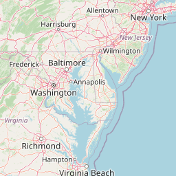



Warmer colors are warmer water. The line where cool blue runs into warm orange is a temperature break — bait stacks on that edge and the fish follow it.
NASA posts these images once a day and can lag a day or two behind. If the water looks empty, step back a day.
Navy pins are the canyons, from the Keys and Hatteras all the way up to Georges Bank, light blue is the wind farm, green are the capes, points, and inlet mouths, purple is reef, hump, and live bottom, white pins are the light towers and bridge-tunnel islands. The dashed line is the 100 fathom edge, where the shelf breaks, on both the ocean and Gulf side. Tap a pin for its numbers. Reference points only — not for navigation.
Hotspots
Canyons and reference points
Every named canyon from Georges Bank south to the Keys, then the humps, reef lights, and bottom the southern run is fished on. Tap one to put it on the map.
Georges Bank to Hudson
Toms down to Norfolk
Hatteras and home water
Florida and the Keys
- Tonight59° · E 11 kt · Cloudy then Light Rain Likely
- Sunday67° · NE 15 kt · Light Rain
- Sunday Night55° · NW 9 kt · Light Rain Likely
- Monday66° · NW 6 kt · Chance Rain Showers then Mostly Sunny
This forecast is automatically generated from NOAA forecast, buoy and tide data, and it can be wrong. Conditions on the water change faster than any forecast. Always check the NOAA marine forecast, your inlet and the radar yourself before you leave the dock.